If you’re in search of a peace and solitude and looking for the ultimate basecamp to escape the masses, Norwood’s Thunder Trails should be at the top of your list of destinations in Colorado for dirt biking, mountain biking, horseback riding and hiking! Located just an hour and a half from Moab, two hours from Grand Junction, and just 40 minutes from both Telluride and Ridgway, Norwood’s Thunder Trails are ideal for a quick day trip to hit the trails, overnight camping, or a weekend getaway!
The Trails
The Thunder Trails are the largest trail system on Wright’s Mesa, offering four loops and 19 miles of fun, flowing singletrack trails, as well as challenging climbs and moderately technical rocky outcrops. The Thunder Trails offer views of Naturita Canyon and Lone Cone Peak while meandering through ponderosa and oak brush forest, and grassy meadows.

Riding season at the Thunder Trails starts as soon as the snow melts and the mud dries, typically mid-April into early May. The Thunder Trails are hikable/rideable spring through fall. While summer temps on Wright’s Mesa range from the high 70s to low 90s, the towering ponderosa pines along the Thunder Trails offer ample shade.
There are four loops that make up the Thunder Trails system, each ranging from 3.5 to 4.5 miles in length. Each loop can be connected and ridden as loops, or as out-and-backs along the east or west sides. The east side of the trail system is the easiest, offering more variety of smooth, rocky and flowing singletrack, while the west side of the system along Naturita Canyon offers more technical, rocky singletrack.
The first loop, Thunder Loop, is perhaps the most popular trail because it takes off from the main trailhead. Thunder Loop offers the best variety of terrain when it comes to a combination of smooth and flowing singletrack, technical downhill and rocky outcrops as well as challenging climbs.
The next three loops in the system, Naturita Rim Loop, Portis Loop and Goshorn Loop intertwine along the top of Thunder Road and offer more smooth and flowing singletrack with very few challenging climbs and technical rocky outcrops mainly on the west side.

The least technical terrain, featuring smoother singletrack can be found along the east side of these loops. The west side of these loops offers generous views of Naturita Canyon and Lone Cone Peak and features rougher singletrack, scattered with more challenging rock sections. Each loop in the trail system can also be accessed along Thunder Road with small parking areas located where each trail intersects with the road.
Hikers and horseback riders looking for easy terrain with minimal climbing will enjoy the east side of both Naturita Rim & Portis Loops, while those looking for more variety in terrain will enjoy Thunder Loop and the west side of the Thunder Trails system. Mountain and dirt bikers looking for trails that are best suited for beginner to intermediate riders will also enjoy riding the east side of both Naturita Rim & Portis Loops. For more advanced riders we recommend Thunder and Goshorn Loops and the entire west side of the Thunder Trails system.
Want to learn more about mountain biking in and around Norwood? Click here!
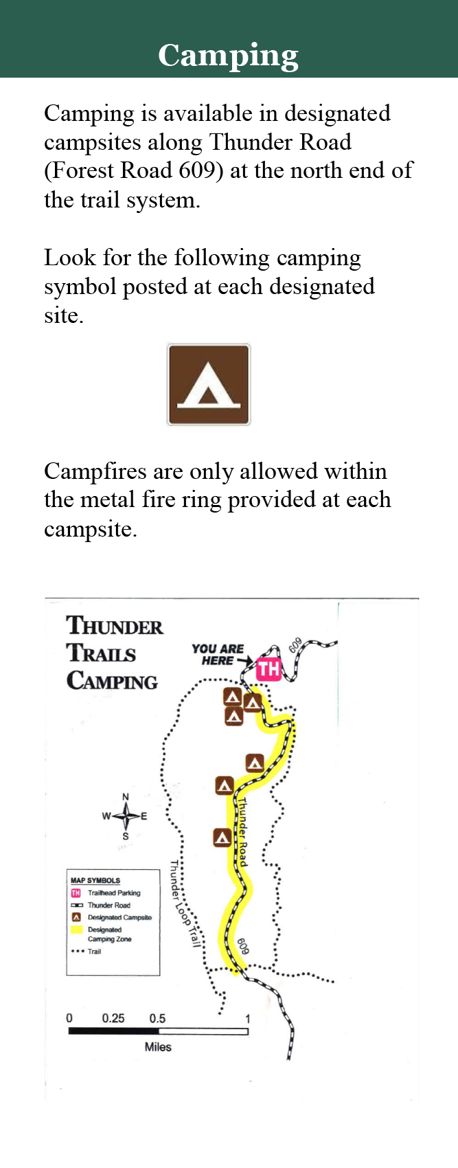
Camping
Camping along the Thunder Trails are just about the best you can get when it comes to proximity to trails as well as the amenities of town. The Thunder Trails camp sites are located within the Uncompahgre National Forest, just four miles and about 10 minutes from the town of Norwood.
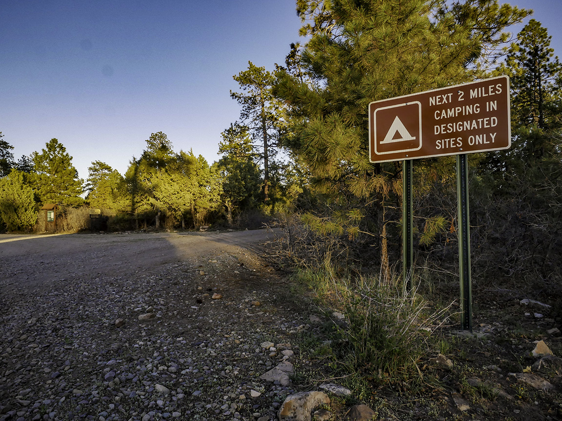
There are six designated campsites, all located within the Thunder Loop within the first two miles of the Thunder Trails system. The campsites are surrounded by oak brush and Ponderosa forests, providing excellent shade and privacy. Camping is primitive, with each campsite featuring only a metal fire ring. Portable toilets are located at the Thunder Trails trailhead. There is no trash disposal available, please pack out what you pack in and dispose of waste properly.
Camping along the Thunder Trails is free, first come first served, suitable for small and large groups, and is perfect for tents, vans and small RVs, as well as trailers. What more could you ask for? Grab your bike, hiking boots, trail running shoes, or your horse and hit the trails right from camp!
Looking for more places to camp around Norwood? Click here! And for more information on camping in the National Forest, please visit the GMUG National Forest website.
Getting There
Getting to Norwood’s Thunder Trails is easy, just follow the signs! The trails as well as camping areas are located approximately 4 miles south of Norwood on Thunder Road and are easily accessible by any vehicle.
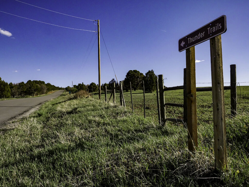
Head to the west side of Norwood along Highway 145 until it intersects with Aspen Street (County Road 42ZS). Turn south and travel 1 mile, then turn right onto County Road Y43. Travel 1/2 mile and turn left on County Road 41.5Y (see a large brown “National Forest Access” sign). Travel south 1.7 miles (the paved road will turn into gravel), then turn right onto Forest Service Road 609. Follow the National Forest Road for 1.2 miles. The Thunder Trails Trailhead parking area will appear on the left, with dispersed camping areas located within the next two miles down the road.
“Leave No Trace”
When camping at the Thunder Trails or within the national forest, it’s important to follow the seven “Leave No Trace” principles:

Plan Ahead and Prepare
- Know the regulations and special concerns for the area you’ll visit.
- Prepare for extreme weather, hazards, and emergencies.
- Schedule your trip to avoid times of high use.
- Visit in small groups when possible. Consider splitting larger groups into smaller groups.
- Repackage food to minimize waste.
- Use a map and compass to eliminate the use of marking paint, rock cairns or flagging.
Travel and Camp on Durable Surfaces
- Durable surfaces include established trails and campsites, rock, gravel, dry grasses or snow.
- Protect riparian areas by camping at least 200 feet from lakes and streams.
- Good campsites are found, not made. Altering a site is not necessary.
In popular areas:
-
- Concentrate use on existing trails and campsites.
- Walk single file in the middle of the trail, even when wet or muddy.
- Keep campsites small. Focus activity in areas where vegetation is absent.
In pristine areas:
-
- Disperse use to prevent the creation of campsites and trails.
- Avoid places where impacts are just beginning.
Dispose of Waste Properly
- Pack it in, pack it out. Inspect your campsite and rest areas for trash or spilled foods. Pack out all trash, leftover food and litter.
- Deposit solid human waste in catholes dug 6 to 8 inches deep, at least 200 feet from water, camp and trails. Cover and disguise the cathole when finished.
- Pack out toilet paper and hygiene products.
- To wash yourself or your dishes, carry water 200 feet away from streams or lakes and use small amounts of biodegradable soap. Scatter strained dishwater.
Leave What You Find
- Preserve the past: examine, but do not touch cultural or historic structures and artifacts.
- Leave rocks, plants and other natural objects as you find them.
- Avoid introducing or transporting non-native species.
- Do not build structures, furniture, or dig trenches.
Minimize Campfire Impacts
- Campfires can cause lasting impacts to the backcountry. Use a lightweight stove for cooking and enjoy a candle lantern for light.
- Where fires are permitted, use established fire rings, fire pans, or mound fires.
- Keep fires small. Only use sticks from the ground that can be broken by hand.
- Burn all wood and coals to ash, put out campfires completely, then scatter cool ashes.
Respect Wildlife
- Observe wildlife from a distance. Do not follow or approach them.
- Never feed animals. Feeding wildlife damages their health, alters natural behaviors, and exposes them to predators and other dangers.
- Protect wildlife and your food by storing rations and trash securely.
- Control pets at all times, or leave them at home.
- Avoid wildlife during sensitive times: mating, nesting, raising young, or winter.
Be Considerate of Other Visitors
- Respect other visitors and protect the quality of their experience.
- Be courteous. Yield to other users on the trail.
- Step to the downhill side of the trail when encountering pack stock.
- Take breaks and camp away from trails and other visitors.
- Let nature’s sounds prevail. Avoid loud voices and noises.
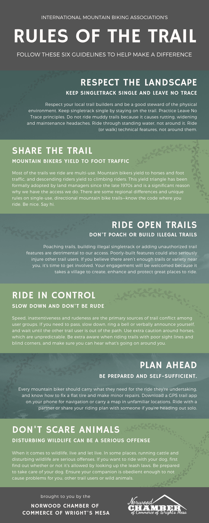
Trail Etiquette
It’s also important to remember that the environment and landscape of Wright’s Mesa is delicate. As tails users and campers, our actions have critical impacts on the landscape, the trails, the animals and other trail users. Riding on muddy trails can be incredibly damaging. Please remember to stay on the trail and walk or ride through mud puddles and standing water, not around it.

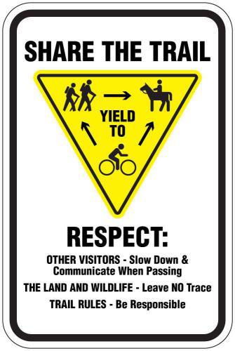
Norwood’s Thunder Trails are considered multi-use trails, meaning they are shared between different user groups including mountain bikers, dirt bikers, hikers and horseback riders. The general rule goes: Bikers, both mountain and dirt bike, yield to horses and foot traffic, and those descending yield to those climbing.
Please remember to follow these Rules of the Trail to help keep the peace and preserve our beautiful landscape.